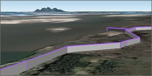
This is a lesson plan using Google Earth to explain the problems of flooding in the Brahmaputra river in India. Flooding has become more of an issue because of global warming and the lesson plan explores the reasons why and also explains the effects of the flooding.
![]() 1. Ice and Floods, Google Earth File
1. Ice and Floods, Google Earth File
![]() 2. Effects of Flooding, Google Earth File
2. Effects of Flooding, Google Earth File
Points about teaching:
- Designed principally for UK teachers but I've tried to make it useful for use in any country.
- Its split in two to give a logical break to a lesson in case it gets over long.
- I've designed it so it gives helpful tips on how to use Google Earth as you progress through the lesson. It assumes no advanced Google Earth skills on the part of the teacher.
- Google Earth is particularly good in this context as it can be used to drape images over mountains, gives students a sense of orientation/scale automatically and plays videos in placemarks.
- The plan is not prescriptive about whether Google Earth is used by the students or by the teacher in show and tell mode - either can be done.
- I plan to do more lesson plans, feedback on how it works in practice would be really useful.

No comments:
Post a Comment